

Gravesend West
''The Diamond Line'' and High Voltage Cable Link
By Peter Dunne
During the 70s and 80s I was a British Rail Cable Jointer's Mate whose duties included maintaining the High Voltage Cable Link (33,000 Volts) from Fawkham Junction Substation, on the Main Line, to Northfleet Grid, now adjacent to Sainsbury's. Apart from the occasional natural cable breakdown, there were also some foolhardy people whose idea of getting rich quick would be to unearth the buried cable, for the most part in concrete troughing. We never actually found any bodies, but on one occasion found a hacksaw part way through the outer sheathing; they or he were so lucky! We also witnessed the last train which ran to the coal depot at Southfleet Station, which must have been in 1976. My boss at the time had been on the railway since the 1930s and he always referred to it as ''The Diamond Line'', it being the preferred route of Diamond Merchants fleeing the Nazis from Amsterdam, en route to Holborn Viaduct for Hatton Garden.
The route of the High Voltage Cable ran from the National Grid site, which is still adjacent to the A2 and Hall Road, in a south westerly direction, obviously following the old track bed across the now demolished A2 steel overbridge on raised metalwork about knee high, still in concrete troughing, but covered in cement for added security. So the cable only ran roughly half the length of the actual line, and had no actual purpose for the line itself as of course it was not electrified. This was a vital link to Fawkham Junction to feed local Southern Railway Substations, which then converted the 33,000 volts down to 650 or 750 volts DC for the 3rd rail voltage. These substations are normally spaced at roughly 3 mile intervals along the track.
I would add that working on that particular line compared to the rest of the larger patch was a pleasurable experience, just like a walk in the countryside without the hassle of avoiding high speed trains coming at you!
22nd April 2006
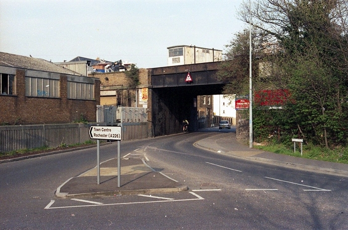
Fast-forwarding to 2006, the majority of the brick viaduct survived at this time, that part to the left of the road in the above view being used for boat storage. The road here is ''West Street'', from where the station once derived its name, and the pier is out of view to the left. © David Glasspool
13th May 2006
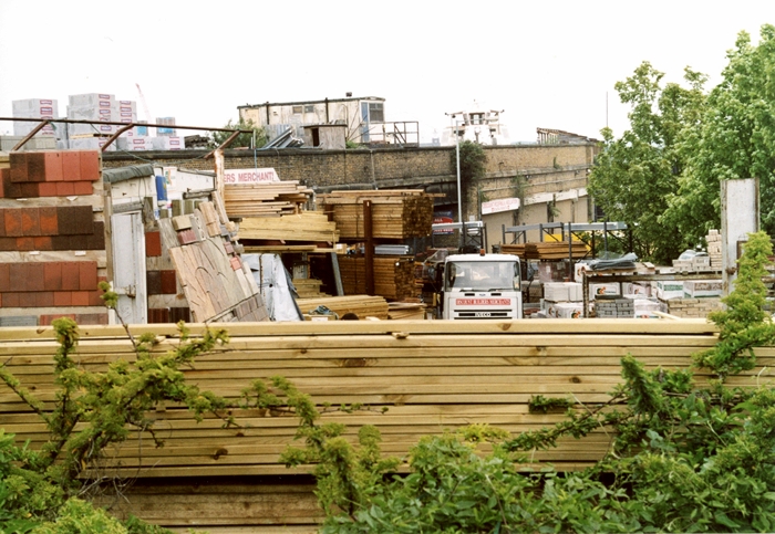
We are now on the opposite side of the viaduct to the previous photograph, looking towards the river, and can still see the portakabin perched on top. The area in the foreground had become home to a builders' merchants. © David Glasspool
13th May 2006

The former railway pier is observed in this westward view from 13th May 2006. The metal framework on view is all that is left of the covered walkway, as seen complete with cladding in the 1991 photograph. © David Glasspool
13th May 2006
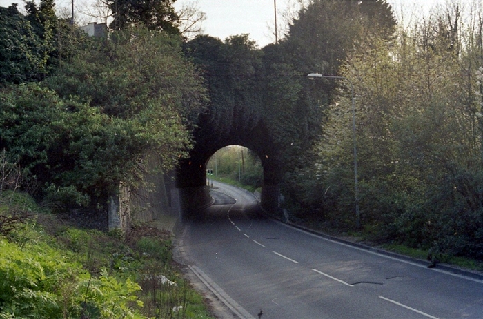
The approaches to the terminus were once upon an embankment, and were reached after passing through the 59-yard-long Rosherville Tunnel. This is a London-bound view towards the tunnel, the opposite side of which was once Rosherville station (closed to passengers as long ago as 1933). During redevelopment work in the early 1990s, the former track bed was significantly lowered (as marked by the concrete within the tunnel), and became host to an access road for a retail park. The latter was built on the former site of the Imperial Paper Mill. © David Glasspool
Return to the Kent Rail Homepage or alternatively, check for Updates.
Website & Copyright information - Links - Contact the Webmaster
All content is copyright © David Glasspool unless otherwise stated